Best Time to Cross the English Channel
Is there anything more satisfying than sailing across the English Channel in your own boat? The sensation of success and independence is indescribably satisfying, and there’s nothing like being out of sight of land to stoke your appetite for adventure. One of the most essential considerations while crossing the English Channel is how long it takes to sail from one end to the other. After all, you don’t want to be caught offshore if the weather worsens.
Sailing across the English Channel in a sailboat can be a gratifying experience. While sailing through an open sea passage such as the English Channel feels like genuine cruising, being out of sight of the shore for even a few hours can be terrifying, particularly for inexperienced sailors. So, in this article, I will provide information about sailing along the English Channel as well as which is the best time to do so. Keep reading!
The English Channel
The Channel is 350 miles long and 150 miles broad at its widest point, but the Dover Strait is only 21 miles wide, so planning and choosing your crossing point is crucial. The English Channel is a thin arm of the Atlantic Ocean that connects England’s southern coast to France’s northern coast, tapering eastward to the North Sea at the Strait of Dover (Pas de Calais). It’s the smallest of the shallow seas that make up Europe’s continental shelf. It covers only 29,000 square miles (75,000 square kilometers).
Although the English Channel is of significant scientific importance, particularly in terms of tidal motions, its location has given it enormous historical significance as a route and a barrier during the colonization of Britain and the creation of modern European nation-states. Near the coasts, the seafloor dips fairly sharply, although it is otherwise level and surprisingly shallow (especially in relation to nearby land elevations). The Hurd Deep, with a depth of 565 feet (172 meters), is one of a number of unusual deep, contained troughs in the western channel’s bed. The western channel’s floor is typically 200 to 400 feet deep and rather flat and featureless.
Tides in the English Channel are often strong, particularly in the Strait of Dover, and can be represented as an oscillation around a north-south line across the channel’s center—that is, a rise to the west followed by a fall to the east. The Gulf of Saint-Malo has the largest tidal range, at 28 feet or more, and semidiurnal (twice-daily) tides are helpful to shipping movements at Southampton, have a double or prolonged, high tide. The weather across the English Channel is often variable. Cloudy, chilly, and rainy, with high winds and low visibility, especially from October to April.
It is fair and dry at other times, with light winds and decent visibility. During periods of inclement weather, daytime high temperatures can reach 54 degrees Fahrenheit (12 degrees Celsius) in the winter and 68 degrees Fahrenheit (20 degrees Celsius) in the summer. When the weather is clear, temperature extremes can range from a low of 23 °F (5 °C) in the winter to a high of 86 °F (30 °C) in the summer. Annual precipitation ranges from 28 to 39 inches (700 to 1,000 mm). Lastly, gales can occur from any direction, but the southwest and west are the most prevalent.
Passage Planning
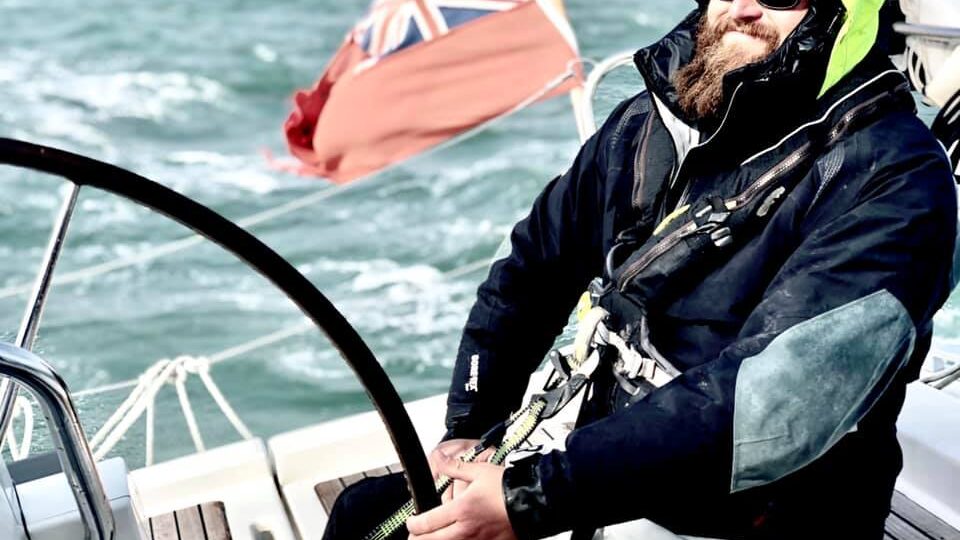
Weather constraints, forecast sources, sea state, and making the greatest use of tides are all important strategic considerations. Shipping lanes necessitate a high level of concentration, yet they are rarely as challenging as they appear to be in theory. You should also have some backup plans in case the weather worsens. It’s natural to be nervous before a voyage, but if the weather prediction seems good, the best part about passages is achieving to cross them. If conditions are favorable, any anxiety issues will go away after a time as you get into the rhythm of monitoring your position and avoiding ships and fishing boats.
When you see foreign land, you may feel the delight of ancient seafarers who battled the storms, but eventually arrived at a strange unknown destination. And, at the end of the day, being moored in a French or Channel Island harbor is a thrill that never fades. When crossing the Channel, you must prepare a passage plan, because without that the chances of an accident maximize. Allow yourself a couple of extra excess hours – Because the weather is weird, it’s better to slow down rather than accelerate up to catch a tide or a sill.
It’s never a smart idea to try to outrun freighters, which typically cruise at 15-18 knots, with some going much faster. The horizon can be deceiving, and they appear to be closing in on you with alarming speed. Keep in mind that the cargo ships’ speed, course, and CPA (closest point of approach) are all provided by AIS. Keep an eye on the wake, which can be rather huge behind a large vessel. Shipping traffic is limited to two traffic separation schemes (TSS), so make a 90-degree turn to ensure you get over as quickly and safely as possible.
There are 13 ferries that cross the channel, so keep a watch out for them and mark them on your charts so you don’t get a 35knot surprise. It’s important to arrive during daytime hours. Foreign ports can be difficult to navigate, and the darkness can obscure markers and entrances. In addition, keep a watch out for fishing pots near both beaches.
Waypoints and routes should be planned ahead of time. Your departure point can be a convenient outer buoy that can be reached by eye, but if visibility is poor on the day, it’s a good idea to add virtual waypoints to the pontoon. Arrival markers for the route to Guernsey, for instance, should continue all the way down the Little Russel to St Peter Port. Summer fogs are notorious in the Channel Islands, but with a detailed itinerary in place, approaching Guernsey in thick conditions is not impossible. Set waypoints within the main breakwater to lead you across the Grande Rade and into the marina for a Cherbourg landfall.
For Channel crossings, neaps are better so as to lessen the likelihood of steep wind-over-tide swells. Bear in mind that fast boats should time their trips to cross slack water or with the wind and tide in the same direction for the same reason.
English Channel Crossing Points
Because of its ease of stay and accessibility to Brittany and Normandy in France, many sailors prefer the Needles or Poole to Cherbourg crossing point. This is a 60-mile journey that begins in Needle or Poole, England, and ends in Cherbourg, France. If you use this route, you’ll only have to deal with large cargo ships and ferries within a 15-mile range, which is manageable. This section is fairly straightforward, and you’ll cross at just the appropriate angles.
You must also keep in mind that the English Channel can become very choppy in the blink of an eye, especially in bad weather, so you must choose a relatively short route. Consider sailing to Cherbourg from Needles or Poole if the weather is good. You must, however, keep an eye out for cargo ships and ferries. Even if you have the right of way while encountering a ship from the other side of the Channel, you should always adjust your speed or course to avoid an accident. Keep in mind that up-Channel ships have right of way and will expect you to stay out of their way.
Any experienced sailor will tell you that a large ship may appear to be stationary, but these massive ships move at speeds of 18 to 25 knots. So, be patient and give way before continuing your journey across the Channel. Note that when the fog rolls in after you’ve already set sail, it can be dangerous. In such cases, the best course of action is to turn around and avoid dealing with the nightmare of poor visibility. If you have any doubts, it may be illogical to continue because you will be putting your life in danger.
As a result, you must always be on the alert, go at a reasonable speed of approximately 6 nautical miles, and think rationally without panicking if you find yourself in an emergency. Even if you cross successfully, keep in mind that Cherbourg is a busy ferry port, and you can safely berth your boat at either the four-mile-wide main harbor or the old and big sheltered marina in Port Chantereyne. Similarly, the Channel Islands are a good stopover, surpassing Cherbourg in terms of beauty and value for money — berths are quite affordable, and diesel is VAT-free. Calais is a good stopover point at the eastern end of the Channel for people traveling east to Holland and Belgium, as well as those berthed in the South East of England.
Always Have a Backup Plan and Sail as a Team
Consider other routes in case the weather forces you to change your plans. Find approach waypoints for Cherbourg as well, for example, for Poole to Alderney, so you may simply detour in a strengthening south-westerly or low visibility. On a voyage to Cherbourg, it’s sometimes worth aiming for a mid-Channel waypoint two or three miles upwind of the direct route. This will give you the option to turn away from the seas if circumstances worsen in the second half of the journey.
Always say your plans to your crew so that they are aware of your thoughts. It creates a more engaging passage and a sense of collaboration. Keep in mind that taking watches is really important for the captain. While the captain will most likely want to keep an eye on things, knowing that the crew is also keeping an eye on things relieves some of the burdens. When you arrive in the French port, use the VHF to request a berth. Despite the fact that many French people speak English fluently, sometimes you might have difficulties in terms of communication.
English Channel Tides
Fast motorboats, in general, benefit little by mapping tidal vectors to select a path to steer to smooth out tidal effects. Slower boats and longer excursions, on the other hand, may notice a difference in time and fuel use. Leaving at night will usually result in quieter, smoother crossings, but it will also result in colder and more difficult navigation.
Watch out for tidal streams along the shore. Keep in mind that high tidal ranges can be found in the Channel Islands and the Bay of Mont St-Michel in west Normandy, with rises and falls of up to 15 meters. If you’re going to the Channel Islands, make sure to time your voyage through the Alderney Race to escape the 10 mph tidal stream during springs. Many French ports have a sill or a lock to access. You should have plenty of time because getting into the lock can be a scramble.
After you’ve made your decision and set your dates, you can start thinking about the tides for your cross-channel trip. You can plan on the prevailing south-westerly winds at this stage, but keep an eye on the forecasts closer to the departure date and be prepared to adjust your plans if necessary. August is a good example of setting sail. This date is a little later than springs, but the tidal range on that day is bigger than the mean, so you’ll have to extrapolate the tidal rates.
Passages on the English Channel
Needles or Poole to Cherbourg
The 60-mile route from the Needles to the west entrance of Cherbourg has a 15-mile strip of shipping at a secure angle. A comparable crossing from Poole almost identically cuts the lanes at right angles. Although these routes are rather straightforward in terms of navigation, they should never be taken for granted. This is because, in the wrong conditions, the English Channel may quickly become turbulent. The bold north shore of the Cotentin Peninsula provides an easy visual touchdown in clear weather and shows up clearly on the radar. You can go a couple of miles east of Cherbourg fairway buoy from the Needles and a little closer from Poole.
Keep in mind that shipping is something you should be aware of. When cruising south from the Needles or Poole, you’ll first come across down-Channel shipping. Although you have notional right-of-way over ships leaving from port in the open sea, unless you are crossing well ahead, try to change course or speed in advance to show you plan to pass beneath their sterns. As you cross the channel from the north, up-channel shipping has the right-of-way and will expect you to keep clear.
When you arrive in Cherbourg’s bustling ferry port, you’ll find Port Chantereyne, a large sheltered harbor near the ancient district. The four-mile-long outer harbor is protected by two entrance gaps and extensive breakwaters. The marina is still two miles away from the main, west entrance. The welcoming yacht club in Cherbourg is always bustling with visitors, and there are some great restaurants around.
Weymouth or Portland to Alderney
The 55-mile run from Weymouth to Alderney is approximately the quickest central Channel crossing conceivable, with few obstacles aside from dodging ships and being aware that the streams may be strong as you approach Alderney. On the English side, one of the Shambles bank buoys east of Portland Bill will be your departure point. The direct route to Alderney almost cuts the mid-channel shipping in half. The proposed route heads well clear of the reefs just two miles west of the Alderney entrance.
Weymouth or Portland to Guernsey
This 72-mile voyage west of the Casquets delivers you to St Peter Port in a day, where you can continue your cruise to Jersey or Brittany. The route runs directly from the Shambles bank to the northeast side of the Casquets up-Channel TSS, skirting it at a right angle. After that, you can continue south towards Guernsey, stopping at a west Casquets waypoint. The descent from the Casquets to waypoint 22 at the north end of the Little Russel, a mile north-east of Platte Fougère lighthouse – a stubby white tower with a black band – is straightforward. The distance between here and the pierheads of St Peter Port is less than five kilometers.
Cherbourg to Alderney
Even though the coastal sections to Alderney and down to Guernsey appear to be less intimidating than the Channel crossing, you must be cautious when crossing the Alderney Race. Even fast boats must carefully time the tides. 50 minutes before HW Dover, on the last of the north-going stream of the Race, is a favorable time to arrive off Cap de la Hague from Cherbourg. The 10-mile jump to Alderney port is then done in slack water. Otherwise, arrive five hours after HW Dover off the coast of La Hague on the dregs of the southerly tide and race to Alderney before the new northerly surge kicks in.
Alderney Race to Diélette
Cutting south from the Alderney Race for the 12 miles down to Diélette on the Cotentin Peninsula is a ‘back door’ option into the Channel Islands. Because this side of the peninsula faces west and its three main harbors are tidal, you’ll need the correct weather. However, if you work the tides in calm circumstances, such as easterlies or soft north-westerlies, this beautiful path south is no trouble. With the tide rising nicely at Diélette, plan to round Cap de la Hague 212 hours before HW St Helier if coming from Cherbourg. If you leave Cherbourg too late, you’ll run into a powerful foul stream off the coast of La Hague.
Diélette has outside waiting pontoons and an inner basin that is only accessible when the tide is higher than half tide. Its seashore is surrounded by typical Normandy buildings, and not far inland is open farmland with meandering paths teeming with skylarks in the summer.
Carteret and Granville
Continuing south from Diélette, you’ll pass by Flamanville power station before arriving at Carteret. It is a bustling tidal port accessible for two hours on each side of high tide. The harbor channel dries to sand, but the marina at its head maintains a 2m depth at the visitors’ pontoons, which overlook the upper estuary’s dunes and marshes. You can make your way to Jersey’s east coast and tuck into St Catherine’s Bay. You can either anchor or borrow a mooring here behind a breakwater.
There’s not much to see ashore, but the scenery is relaxing as you consider whether to continue on to Granville or cut through Les Minquiers and Îles Chausey to reach St Malo and the Rance River. If you catch the flood tide, Granville is also a simple run from St Helier. The proposed route passes considerably north-east of the NE Minquiers buoy, the Les Ardentes buoy, the L’Etat black-and-white beacon on the Chausey plateau, and lastly between two E-cardinal buoys east of Chausey. Then swing in towards Granville, steering SSE to round Pointe du Roc. It’s a good idea to get there two hours before high water.
St Peter Port to Saint Malo
The 54-mile passage from St Peter Port to St Malo departs from Sark to the east, passes six miles off Jersey’s west coast, and skirts the west border of Plateau des Minquiers, just outside the NW Minquiers N-cardinal and SW Minquiers W-cardinal buoys. From St Peter Port, sail west of the SW Minquiers buoy to a waypoint west of the outer buoys of St Malo’s Chenal de la Grande Porte. Then follow SSE to the outer buoys of St Malo’s Chenal de la Grande Porte. Cap Fréhel, which comes on the starboard bow as you approach the SW Minquiers buoy, is usually the first French land you see. Closer to St Malo, the Île de Cézembre’s unique hump rises over the mainland coast, followed by the old town’s great church steeple.
>>Also Read: Best Time to Cross the Atlantic by Sailboat
The Bottom Line
So, what is the best time to cross the English Channel by sailboat? The best time to cross the English Channel by sailboat is from late May to early September. Note that the voyage can take anywhere from a few hours to several weeks to complete. It all depends on the size of your boat, its speed, the wind, and the passage you choose. If there is a calm south-westerly breeze with neap tides, sailing from Dover, England, to Calais, France, can take about 5-6 hours. You could even wait a week for good winds or weather, especially if the wind is blowing in the incorrect direction, in which case you may have to wait till the wind changes.
You should allow adequate time to cross the Channel, and even more time if possible. This is necessary to ensure that you cross only when the weather conditions are good. As previously said, do not attempt to outpace the cargo ships, and always keep in mind that the horizon might be deceiving, therefore your safety should always come first. Crossing throughout the day is also an option. While sailing at night may provide smoother and calmer crossings, it is typically very chilly, and maneuvering your sailboat in the dark can be difficult.
You should also bear in mind that many French ports use the lock-to-enter system, so allow plenty of time, especially if you don’t want to have to rush through the lock. So, if you’ve been thinking about crossing the English Channel and looking forward to enjoying the stunning views, food, and experiences, you should be aware of the requirements for both you and your boat. I hope this article was helpful to your route planning and I wish you all safe and pleasant voyages!