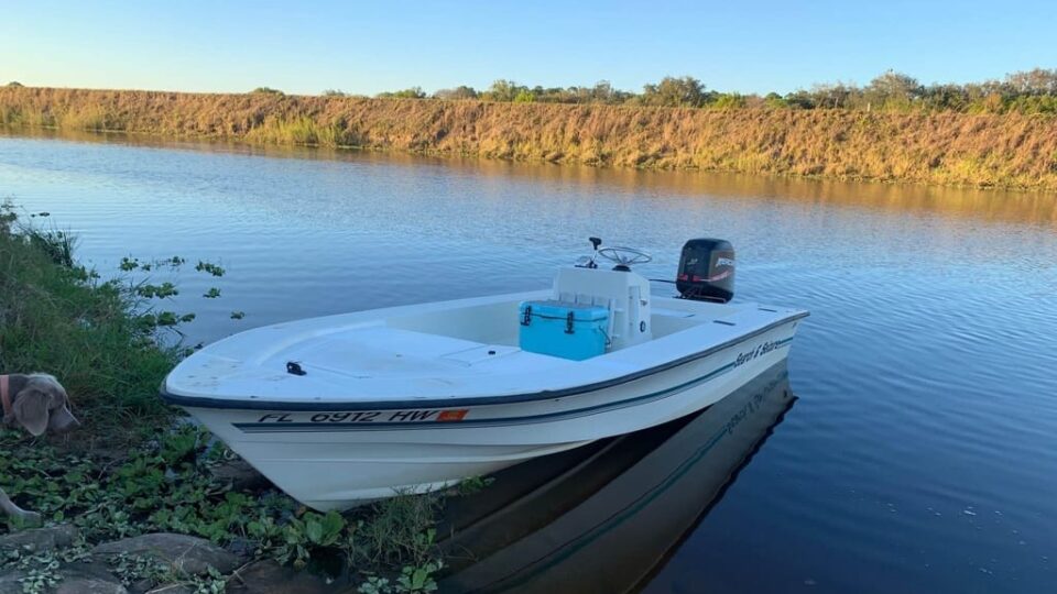
Best Boating Rivers in the US
The United States features some of the world’s most stunning and diverse landscapes. Natural hidden treasures can be found all across the country that can only be reached by boat, as well as experiences that can only be obtained over the course of several days on the water. Because rivers are so important, communities, towns, and cities have sprouted up around them since the dawn of civilization. Thousands of wonderful rivers crisscross the United States, and many of them draw people who swim, fish, and go boating on a daily basis. So, let’s see the best boating rivers in the US in order to give you some ideas about your next voyage, follow me!
Here Are Some of the Best Boating River Destinations in the US
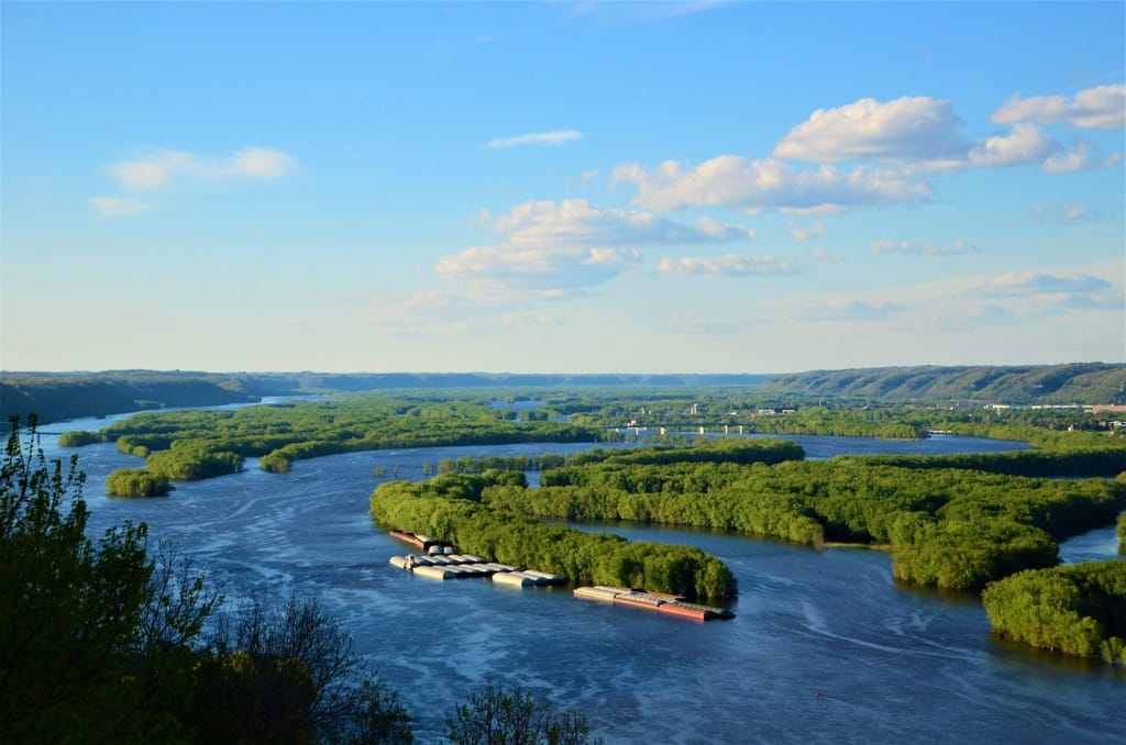
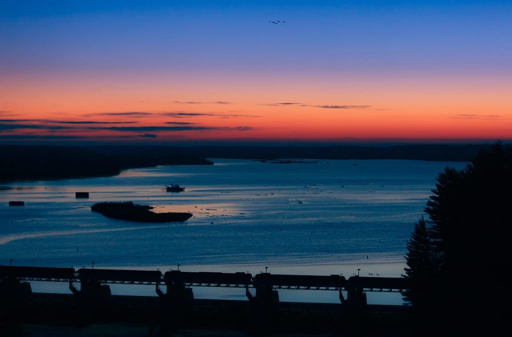
Upper Mississippi River, Minneapolis to Iowa
From Minneapolis, Minnesota, to the Iowa border, the river offers some really unique American vistas and experiences. The Mississippi Gorge Regional Park, known for its high limestone cliffs, is the greatest attraction. The Mississippi National River and Recreation Area, which is peppered with parks and marinas, is where you’ll be spending the next 45 miles. The last portion of the journey to the Iowa border includes a combination of remote wilderness, sandy beaches, and amenities. The vast river’s higher sections are a complete contrast to the lower stretches, yet they have their own magic. During the fall months, take a sail along the riverbanks, which are bathed in crimson and gold hues. Note that you will need at least one week to totally enjoy this voyage.
>>Also Read: Best Boating Lakes in the US
Lower Mississippi River, Memphis to New Orleans
Firstly, note that there are two halves to the Mississippi River. The river’s navigable segment begins at Minneapolis’ Coon Rapids Dam. The Mississippi River is known as the Lower Mississippi River from Cairo, Illinois to the Gulf of Mexico. The Mississippi is known as the Upper Mississippi River north of Cairo. The “Lower Mississippi River” section is 859 miles long and begins at the Ohio River’s confluence in Cairo. The Lower Mississippi runs south of New Orleans before crossing the ICW. So you’ll travel 859 miles from Cairo to New Orleans and 1,078 miles from Grafton.
Keep in mind that the length of time it takes to go down the Mississippi is determined by where you begin, how fast you move, and how many hours you travel per day. While the Tennessee-Tombigbee route has dozens of marinas between the Ohio River and the Gulf ICW, the Lower Mississippi River has only two marinas between Hoppies Marina and New Orleans. Also, on the lower Mississippi, there is a section when it is over 400 miles between stations to refuel.
Of course, the Mississippi River is entirely navigable by boat. On the upper 482 miles of the Mississippi River, however, you are limited to a kayak or rowboat. Depending on your planning, traveling the Mississippi by boat might be a fantastic adventure or a disastrous failure. If you don’t plan ahead and make sure you account for everything, your dream trip could turn into a nightmare. So, you have to locate all fuel stations along your route, provisions, and no matter which route you take, always keep an eye on the weather forecast.
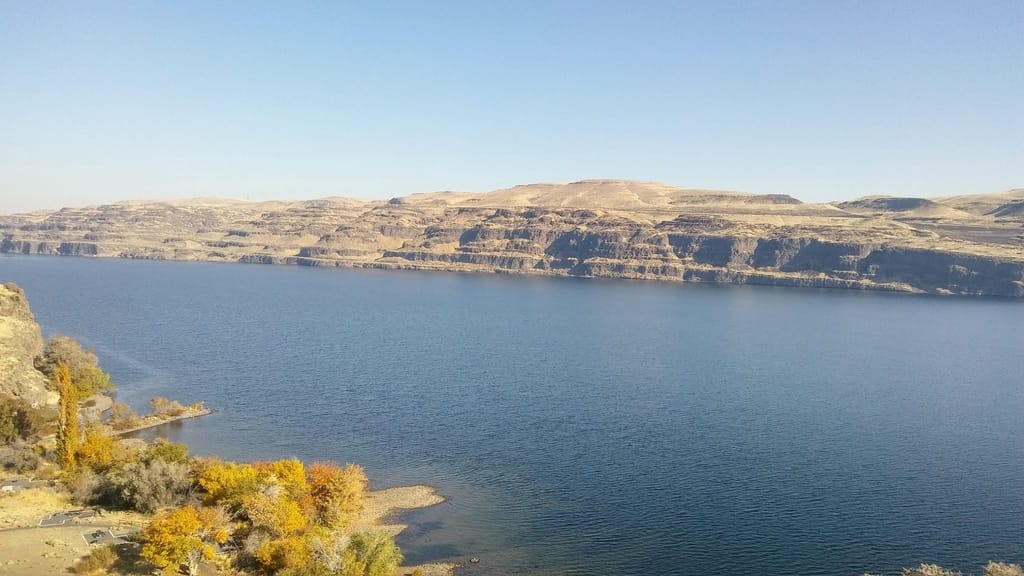
Columbia and Snake Rivers
If you want to follow the footsteps of the Lewis and Clark Expedition as they made their way to the Pacific, boating along the Columbia and Snake Rivers is a must. The Snake River flows from Clarkston, Washington, through a 140-mile scenic canyon rich in wildlife and Native American history before joining the Columbia River near Burbank. It then continues for another 200 miles to Portland, Oregon, passing through various historic villages along the Oregon Trail. The Columbia is a lot bigger than the Snake, and it offers a lot more facilities. After passing through the Columbia River Gorge and witnessing the picturesque Mt. Hood peak over the horizon to your south, you’ll arrive in Portland. With a total length of nearly 300 miles, this journey is a major undertaking that necessitates much planning. However, you’ll find it well worth the effort as you camp, go boating, and sight-see.
>>Also Read: Best Places for Sailing in the US
The Great Loop
The Great Loop is a continuous waterway that comprises parts of the Atlantic, Gulf Intracoastal Waterways, the Great Lakes, Canadian Heritage Canals, and the inland rivers of America’s heartland. If you start in Chicago, you will head south in a counter-clockwise manner to take advantage of the Mississippi River’s river currents. While a few people continue on the Mississippi all the way to the Gulf of Mexico, the majority of ‘Loopers’ choose to exit at the Tennessee River to avoid the larger waterway’s heavy barge traffic. The Tennessee-Tombigbee Waterway, which likewise runs to the Gulf, is reached via this route.
You can also visit Gray’s Reef National Marine Sanctuary by traveling north along the Intracoastal Waterway. And, take the Intracoastal north to New York City. Note that it’s a direct shot up the Hudson from the Big Apple to the Erie Canal. Then continue west to the Great Lakes. When sailing up Lake Huron and then back to Chicago, you can also stop at Thunder Bay National Marine Sanctuary.
Tennessee River
Cruising the Tennessee River’s waters as part of America’s Great Loop is a vacation that should be on everyone’s bucket list. The cliffs that overlook the Tennessee River provide spectacular vistas of the river. Note that the river flows over 652 miles and is the greatest tributary of the Ohio River. Several lakes have formed as a result of the construction of numerous dams along the Tennessee River.
As the Tennessee River is part of the Great Loop, it allows boaters to go around the United States without ever leaving the river. Keep in mind that before planning a trip down the Tennessee River you have to decide whether you want to go up or downriver. Between Knoxville, TN, and Kentucky Dam, where the Tennessee River meets the Ohio River, there are nine locks and dams. If you’re going downstream, each lock acts like a bathtub, lowering you to the next lake below the dam. Going upriver, on the other hand, means your boat will rise to the next lake.
This itinerary includes numerous options for overnight hotels and sightseeing stops along the way. In a four-state region, you’ll come across river cities, historic landmarks, friendly marinas, and southern cuisine.
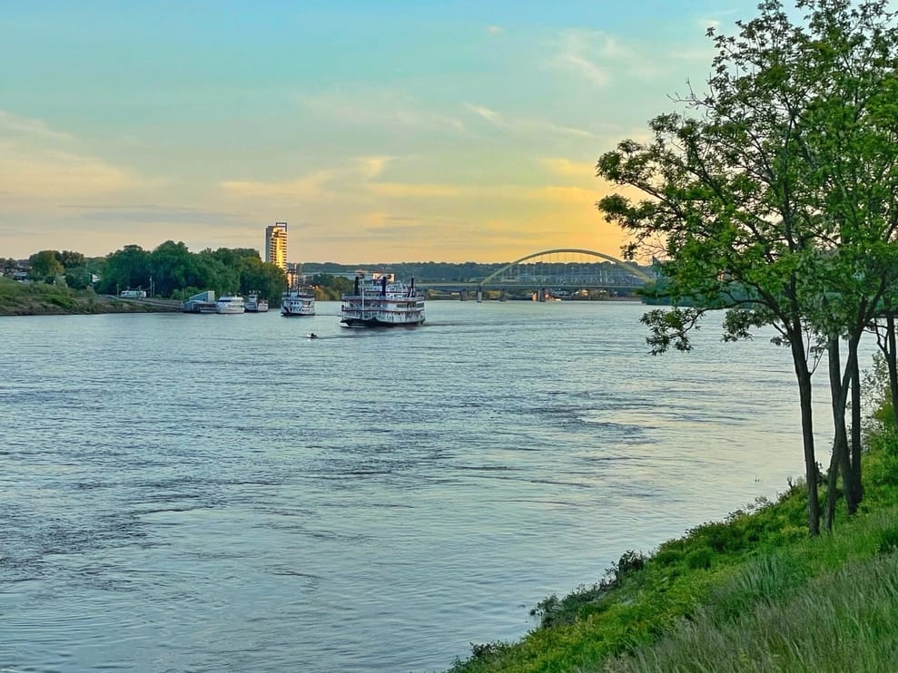
Ohio River, Pittsburgh to Cincinnati
Today, the huge Ohio River – which can be up to a mile wide in sections – is a busy highway, with leisure boaters and commercial vessels alike drawn to its stunning natural beauty and role as a transportation center. As you sail the magnificent canal, go on a trip through American history and culture. Note that the Battle of Point Pleasant, a pivotal event in the American Revolution, took place at the junction of the Ohio and Kanawha rivers in Point Pleasant, West Virginia. For this reason, many of the locals are descended from the initial soldiers and settlers.
Then it’s on to Maysville, Kentucky, for spectacular views of the magnificent river, before arriving in Cincinnati, Ohio, at the 981-mile Ohio River’s mid-point. This pulsing metropolis is brimming with culture, thanks to its museums of art, history, and sports. Those looking for a bigger challenge might continue their journey to Louisville, Kentucky, and tackle the entire river.
Illinois River, Chicago to Grafton
This 327-mile journey offers the best of both worlds, with the first part providing just the proper facilities and nightlife, and the second leg providing a vacation from modern life’s trappings. Starting in Chicago Harbor on Lake Michigan, boaters navigate the Chicago River through the heart of the city, taking in some of the city’s best views. As you travel further, the downtown gives way to nature preserves and suburbs until you reach the Dresden Island Lock. This is where the Chicago River meets the Illinois River. The scenery gets more agrarian at this point.
Before continuing on the second half of the journey, make a stop in Peoria. There the riverfront food and entertainment are well-known among boaters. Following Peoria, the towns get smaller and farther apart. They are separated by miles of wide fields and farms, providing ample opportunity to ponder the meaning of the term “heartland.” Your adventure will come to a close at the Grafton Harbor Marina, which is located at mile 0 on the Illinois River, where it meets the Mississippi.
>>Also Read: Best Boating Towns to Retire in the US
Colorado River
The Grand River rises from a chilly mountain trout stream on the Continental Divide in Colorado’s Rocky Mountain National Park to a classic Western waterway through craggy gorges between broad ranchlands on the upper portion of a 1,450-mile journey. It’s definitely worth it to take a week off and float on the Colorado River for a once-in-a-lifetime experience. The Colorado River twists its way through an ever-changing environment where nature reigns supreme, forming a natural boundary between Arizona and California. The Mohave Desert unfolds in all its bleak beauty from Lake Mead and the Davis Dam. And, this is before the Havasu National Wildlife Refuge emerges in a blaze of jagged cliffs, sandy beaches, and blue skies. This will be an epic experience through vast landscapes and uncharted territory.
Lower Savannah River, Augusta to Savannah
The lower Savannah River, which stretches approximately 200 miles between Georgia and South Carolina, is scarcely used by boaters. This stretch of the river is one of Augusta’s best-kept secrets. The Army Corps of Engineers dredged and maintained the lower Savannah River as a bustling shipping route. However, it was abandoned in 1979 and has remained virtually unchanged since. The river is constantly shifting due to its untamed nature, and it might present more of a challenge than many boaters are used to.
Keep in mind that this section of the river necessitates particular caution and the ability to correctly read charts. You will need two sets of charts. One for Augusta to Brier Creek and another for Brier Creek to the Atlantic. And, it’s advisable to have company while boating the river. This is because the lower Savannah River is so remote that you may go days without seeing another person, and cell reception is spotty. Because there are no petrol stations, marinas, or convenience stores, boaters must be entirely self-sufficient and pack enough provisions.
Hudson River Valley, New York
The Hudson River reveals life along New York’s famous waterway and the life that throbs on its shores, from the depths of nature to an urban artery. Set sail from bustling, enigmatic New York City along a river that passes millionaire’s mansions, nautical museums, vibrantly colored woodland banks, and the captivating communities of Poughkeepsie and Albany.
The Hudson River Valley stretches 150 miles above the tip of Manhattan. Boating along the river is a lovely journey rich with history, culture, local food, and nature. The Hudson River Valley National Heritage Area covers about 4 million acres and stretches from Albany to New York City’s northern border. The region is home to five National Historic Sites, 58 National Historic Landmarks, and numerous historic sites. Historic buildings, parks, landscapes, and waterways dot this 150-mile valley, providing visitors with a wealth of opportunities to learn about people, places, and events that shaped America’s history.