Sailing Across the Gulf of Mexico Itinerary
The Gulf of Mexico, Central America, and the Caribbean are made up of small, interconnected ocean basins. These are chains of oceanic islands with varying land areas and topographic elevations. There’s also the isthmus of Central America, which connects North and South America. The region’s diversity allows cruisers to partake in a wide range of activities, and after a week or two, you’ll feel like you’ve been gone much longer. The Gulf of Mexico is a popular sailing destination due to the numerous sailing regions it has. However, you must take precautions before setting sail. This is because of the changing weather patterns, numerous oil rigs, etc. In this article, I will give you information about the Gulf of Mexico, and the safe itinerary you can make in order to explore the most out of it. So, keep reading!
Information about The Gulf of Mexico
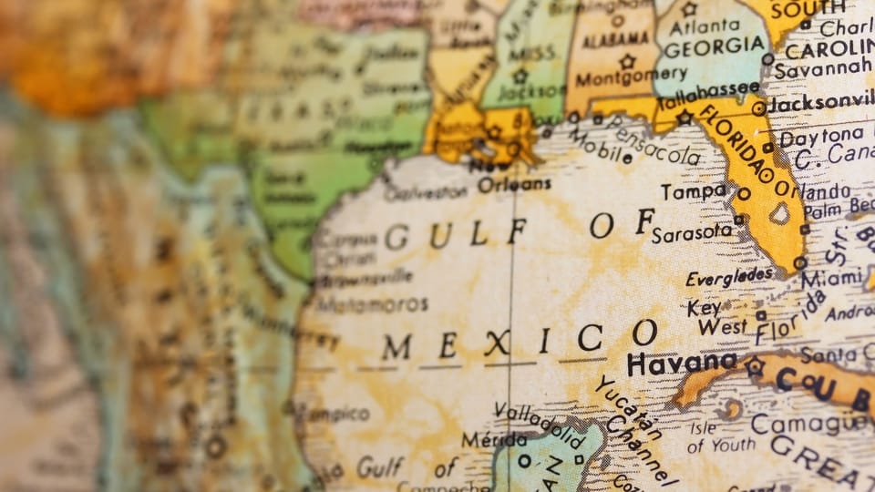
The Gulf of Mexico, which runs between the peninsulas of Florida and Yucatan, is a fantastic destination to visit, live, and sail. The sugar-white sand beaches of the Alabama and Florida Gulf coasts are without a doubt some of the most magnificent on the globe. And, keep in mind that it’s not just another waterway. It’s a complex ecosystem with a long and fascinating history. The Gulf of Mexico not only borders five US states – Texas, Louisiana, Mississippi, Alabama, and Florida – but it also borders Cuba and a portion of Mexico.
The Straits of Florida, which run between the Florida peninsula and the island of Cuba, connect it to the Atlantic Ocean. And, the Yucatán Channel, which runs between the Yucatán Peninsula and Cuba, connects it to the Caribbean Sea. Both of these canals have a width of roughly 100 miles. The Gulf of Mexico’s greatest east-west and north-south extents are around 1,100 and 800 miles, respectively. The southern shore of the United States borders it to the northwest, north, and northeast. The east coast of Mexico borders it to the west, south, and southeast.
The coastal zone, continental shelf, continental slope, and abyssal plain are the most important ecological and geologic provinces in the Gulf of Mexico. Sandy beaches, mangrove-covered areas, and several bays, estuaries, and lagoons make up the coastal zone. The continental shelf creates an almost continuous terrace surrounding the gulf’s edge, with a width that ranges from more than 200 miles to less than 25 miles. The continental shelf, which extends from the west coast of Florida to the Yucatán Peninsula, is mostly made up of carbonate material.
>>Also Read: Top Sailing Destinations In The World
What to Be Aware of When Sailing in the Gulf of Mexico
Gulf County is bordered on all sides by various forms of waterways. It has almost 244 miles of beachfront, ranging from pristine waves and white sand beaches to peaceful inland passes. The Gulf of Mexico is easily accessible and offers excellent deep-sea fishing and boating opportunities. The renowned Dead Lakes is home to one of Florida’s most diverse ecosystems. Through Lake Wimico, the Intercoastal Waterway flows east and west. Indian Pass Lagoon is also known for its natural beauty, uncrowded beaches, and excellent fishing.
But, bear in mind that there are two issues with the Gulf of Mexico. Firstly, it is mostly coastal cruising – not so many islands, but an unbelievable number of gas/oil rigs that are major hazards. Secondly, there is little variety in any of the places other than the US coastline. These are from Florida to Texas and Mexico’s coastline from the border to the Yucatan. Still, that’s a lot of new and diverse experiences to choose from. The Caribbean Basin, on the other hand, runs from Cuba to Antigua, south to Trinidad, Venezuela, west to Panama, and north to Mexico.
So, sailing across the Gulf of Mexico has some dangers which you should be aware of before setting sail. Let’s explore a bit of the past and the Gulf’s current weather patterns.
Weather Patterns and Risks in the Gulf of Mexico
Firstly, note that the temperature of the Gulf Coast region climbed from the turn of the century until the 1950s. This is when it began to decrease significantly. Since then, there has been a resumption of a general warming trend. The Gulf Coast region has experienced the most warming in the Southeast of the United States over the previous century. Also, note that much of the warming has happened in winter since the 1950s. Annual precipitation has grown by 20-30% over the same time span. And, the last ten years look to be increasing wetter.
Because of the El Nino, which has caused unusual weather in many regions of the world, 1997 was the warmest year of the century. This applies in terms of land and sea surface temperatures. El Nino has also played a role in the extra moisture on the Gulf Coast. Sea-level rise as a result of melting polar ice and thermal expansion of warmer waters has been one of the most devastating consequences of climate change on Gulf Coast habitats throughout the last century. Sea-level rise has already had considerable effects on coastal communities, and these effects are only expected to worsen.
Apart from the high levels of pollution, the Gulf of Mexico is known for its regular hurricanes. Because it is located in the equatorial region, the Gulf is warmer than other parts of the Atlantic Ocean. This temperature difference creates huge vortices in the air and water, resulting in hurricanes. Hurricanes that originate in the Atlantic Ocean are quickly fueled by the Gulf’s warm climate. They move westward into the US and Mexican mainlands, especially harming Florida and Texas in the US. Hurricane Katrina, which hit the United States in 2005, was a catastrophic meteorological event. The hurricane took many lives and destroyed a lot of property.
Then, there’s the risk of cyclones in the Gulf of Mexico. A tropical cyclone is a rotating, structured system of clouds and thunderstorms. It has a confined low-level circulation that forms over tropical or subtropical oceans. Cyclones in the Northern Hemisphere tend to rotate counterclockwise. Also, tropical cyclones that originate between 5 and 30 degrees latitude usually migrate westward. The winds in the upper levels of the atmosphere can sometimes shift. This makes the cyclone steer to the north and northwest. These cyclones frequently migrate northeast when they reach latitudes near 30 degrees north.
Keep in mind that the Atlantic hurricane season lasts from June 1 to November 30th, whereas the Eastern Pacific season lasts from May 15 to November 30th. Lastly, note that the Atlantic basin comprises the Atlantic Ocean, the Caribbean Sea, and the Gulf of Mexico.
Going from East to West or Going Reverse?
Let’s set an example of the neighboring Atlantic Ocean. Surprisingly, sailing across the Atlantic from west to east is often seen as a slower passage. And, this is despite the fact that most records are set in this route. The reason for this is that the west to the east route is often windier, making it ideal for fast-racing sailboats rather than normal sailboats. Passing the Atlantic from east to west for sailing should take 3-4 weeks, depending on the size of your sailboat.
To begin with, if you’re sailing across the Atlantic in a small boat, your journey will take longer. Anything less than 35 feet will likely increase your travel time to roughly 4 weeks and possibly a few days more. Furthermore, the distance between the trough and crest of waves on the open sea will be far longer than what you would ordinarily encounter closer to shore. As the waves pass beneath the smaller boats, they will roll substantially more from side to side.
So, what is best to do? Going from east to west or the other way around? The east-west crossing is unquestionably the most popular. The reason for this is that the westbound trade winds pass over considerably sunnier and warmer latitudes than the eastbound trade winds. There are a few popular east-west routes to choose from. Northern routes are generally shorter and faster, but southern routes are designed for comfort and safety.
>>Also Read: Best Places for Sailing in the US
Sailing from East to West
Despite its serenity and abundance of locations, Florida’s Gulf coast does not appear to attract the same level of attention as the east coast. And perhaps that’s a good thing, as it adds to the region’s allure. The region’s diversity allows cruisers to partake in a wide range of activities, and after a week of sailing, you’ll just want to continue much longer.
Larger cities like Sarasota, Tampa, Naples, and Ft. Myers dot the landscape, which is peppered with hidden jewels like the Little Shark River and the Pine Island Sound. Keep in mind that both the east and west coast of the Gulf of Mexico have many lovely sailing areas and extraordinary places to visit.
So, if you choose to sail from the east to the west your departure points will be from Florida, Georgia, Alabama, Mississippi, or Louisiana. If you’re setting sail from Gulfport, MS, or Mobile, AL note that both have old town vibes and great historic yacht clubs. Also, Pensacola Bay offers excellent fishing and snorkeling/diving opportunities. On both sides of the bay, there are two historic forts worth visiting. Destin and Panama City, located further east on the panhandle, have gorgeous beaches and interior bays.
If you want to sail from Pensacola (FL), Panama City (FL), or Mobile (AL) to Cancun, note that going around Texas is a really long route to take. You’ll see a few platforms near to shore as you leave Mobile Bay and head south, but they’re simple to avoid. Even so, there’s a good chance you won’t run into one. The thing to be concerned about in the Gulf is inclement weather, especially if you get caught in the loop current and the wind is blowing against the current.
The coast and inland waterways of Alabama and the Florida panhandle are both stunning, as are the barrier islands off the coasts of Mississippi and Alabama. Alabama and Florida’s inland bays are fantastic. Louisiana boasts lovely parts of the ICW, and most sailors love the places there. Lake Pontchartrain is a great way to get to New Orleans, which is known for its food and alcohol. Port Aransas is a popular sport fishing destination. Texas has numerous beautiful spots to explore, and Galveston is a charming old town. You can sail south to Padre Island, which has beautiful waters and beaches. Also excellent Mexican cuisine. Even if there are many oil patch locations, drillships/platforms get fewer and farther between, and they are well lit.
>>Also Read: Is It Dangerous to Sail in the Caribbean?
Proposed Routes from the East to the West
Some travel right across the Gulf to Isla Mujeres, a little island off the Yucatan’s northwestern coast. If you take this route, make sure you know where the loop current is before you set sail, or you’ll end yourself bucking a 3-knot current in the incorrect direction. Another option is to sail down Florida’s west coast to Key West, then to the Dry Tortugas, and finally to Isla Mujeres.
Alternatively, you can follow the coast (or ICW) to Brownsville, Texas, and then along the Mexican coast around the Yucatan to Cancun. Progreso Mexico, the port area for the city of Merida and all the nearby Mayan pyramid monuments, is a must-see area. When the weather permits, you can, of course, take shortcuts outside. If not, use the ICW.
You might want to set sail from Pensacola directly to Yucatan. Note that in order to avoid the loop current, head east for a few miles before turning south and crossing back to Isla Mujeres in the last 50 miles. In 93 hours, you’ll have covered over 600 miles. You might not even notice oil platforms if you go this route. If you’re worried about that consider leaving from Mobile, and head east to Pensacola first. It’s a fantastic route, and Isla is a fantastic destination. Don’t forget to check the Gulf pilot charts for the time of year you wish to travel.
Lastly, note that the typical route from Brownsville south is El Mezquital to La Pesca and to Tampico. Then you can continue south to Heroica Veracruz, Coatzacoalcos, Ciudad del Carmen, Campeche, and Merida.
Sailing from West to East
Note that the Mexican mainland’s east coast (not including the Yucatan) is not particularly inviting. So, cruisers rarely visit this area. The Texas coast isn’t much better. Both are oil patch locations that have been industrialized. There are a few exceptions along the way, such as Rockport and Port Aransas, Texas. As you travel east, the oil patch thins out and becomes very sparse by the time you reach the Gulf of Mississippi and Alabama. There is no offshore drilling in Florida, hence there is no oil patch. Many sailors state that the best cruising in the Gulf of Mexico begins at the western end of the Mississippi Sound and extends all the way to the Florida Keys.
Southern Louisiana, particularly the Barataria Waterway area, is very interesting, but it’s best explored with a small sailboat. Note that the Waterway Guide covers the whole Gulf of Mexico coast’s Atlantic Intercoastal Waterway. Except for the “big bend” (Apalachicola) in Florida, the ICW traverses the length of the Gulf of Mexico coast. Individual cruising guides exist for specific sections of the Gulf, but most of them are outdated. For the Texas Coast, check Claiborne Young’s Guides and Campbells.
Note that when it comes to cruising, there’s a difference in how “islands” are defined. For example, barrier islands along coastlines and continuous islands (such as the Keys) are certainly “islands,” as is the entire eastern United States. This is because the east coast may be circumnavigated by water up and west to the Great Lakes, down the Mississippi to the Gulf, and back to the east coast.
The thing about the West to East route is that even if it has some beautiful spots along the shoreline, there are hundreds of miles of ugly industrialized shallow coast. Apart from the weather hazards and some areas with shallow bottoms, there are lots of fishing boats and oil platforms.
However, you shouldn’t rule out the north and west coast of the Gulf of Mexico. Also, the further you get from the coast, the fewer and farther apart the oil platforms become, as well as the larger and brighter they become. The most dangerous are the small old platforms near the coast.
There is nice cruising from Mississippi Sound to the Keys, but you won’t find the Western Caribbean’s gorgeous seas and reefs there (except in the Keys & Dry Tortugas). With the exception of the leap around Apalachicola, which is just an overnight run, all of the places along that coast are only a day’s sail away.
Places you Can Visit Along the Crossing
About 70 miles west of Key West lie the Dry Tortugas. It is a National Park System and it’s uninhabited. The Florida Keys are another option. On Florida’s west coast, there are many more islands. Several uninhabited tiny islands off the coast of Alabama. Also, Horn Island, Deer Island, East Ship Island, Ship Island, and Cat Island are all located on the Mississippi coast. They’re all deserted, and the majority of them are part of the National Park System.
The Mississippi Coast is barely 25 to 30 miles long. The Chandeleur Islands, located west of Mississippi, are noted for their excellent fishing. These are located approximately 25 miles off the coast of Gulfport, Mississippi. There is a significant diversity of sceneries from the Dry Tortugas to the Florida Keys and north several hundred miles and over 1000 miles of shoreline on the northern coast to roughly 600 miles due south over open water to the Yucatan Peninsula.
Sailing from the West Coast of Florida
So, if your starting point is the West Coast of Florida you have 2 main options. Firstly, you can sail directly to Mexico and stop in Cuba if you have the time. Or, you can sail across the Gulf from Florida to Texas and include some stopover locations. As long as the wind and weather cooperate, you can set sail and travel east to Florida. Bear in mind that September 1st is the peak of hurricane season. They can develop up in the Caribbean Sea instead of the Atlantic, giving you far less time to perform evasive maneuvers.
If you’re driving down the Florida coast south of Tarpon Springs, there are plenty of spots to stop. However, there are none for sailboats north of Tarpon Springs. At least, none that don’t require you to precisely time the tide. However, the panhandle is not included.
Between Mobile and Carrabelle, the ICW comes to a halt at Carrabelle and resumes at Tarpon Springs, and there are various sites to make landfall there. Furthermore, even if the wind or weather is against you on the outside, you can still make headway along the ICW. Another advantage is that once you’re in Florida waters, so there are no rigs. The current from Key West to Cancun, however, can be a risk. Lastly, bridge heights can be a concern if your boat is taller than 48 feet. Along the Florida panhandle, there are only a few that are 49 and 50 feet long. Note that this route goes from west to east.
Sailing Safety Tips When Sailing Across the Gulf of Mexico
- Always be aware of the weather patterns. Before you go out on the ocean, check the weather and tides. And, check it again before you leave if you haven’t already. Checking the tides not only saves our marine life and seagrass from prop damage, but it also keeps you from running aground if the water is too shallow. There are excellent weather resources to utilize while planning your voyage in the Gulf.
- Always keep in mind the nautical rules. Keep a proper lookout and respect the buoys and other navigational aids that have been established to guarantee your safety as well as the safety of the local wildlife and other boaters.
- It’s important not to forget to get dressed in layers. You don’t want to become cold if the air picks up on the water, even if it’s warm on land. So, be ready for changes in the weather. During long journeys out on the sea, layering can also aid provide additional sun protection.
- Always have a boat safety kit, a first-aid kit, and enough provisions. You can’t always predict when an emergency may occur, so be ready for everything. Always make sure your boat is equipped with the necessary safety gear. It’s preferable to have it and not need it than to require it and not have it. Pack twice as much food and water as you think you’ll need. As you may know, sailing can make you really hungry and thirsty.
- It’s important to make use of your common sense. Meaning that you should maintain a safe speed at all times (particularly in congested locations), don’t be in a rush, and dock your boat when the weather isn’t in your favor. You should also stay away from large vessels and crafts with limited stopping and turning capabilities.
- Keep proper docking practices in mind. If you land too quickly, you risk damaging your boat, the dock, another vessel, or even injuring yourself. If things aren’t going well, don’t be afraid to step back, relax, or seek assistance.
Sailing Across the Gulf of Mexico Itinerary – The Bottom Line
As you can see, sailing across the Gulf of Mexico involves a variety of options when it comes to routes. You can either sail from the east to the west or the reverse. Many sailors choose to sail from the west coast of Florida while others depart from Texas sail directly to Yucatan or along the shoreline. Another popular route starts from Pensacola (FL) to Isla Mujeres or from Mobile (AL) to Cancun. There are many routes that you can take but it’s up to you which one to choose. The route you’re going to choose depends on the available time you have, the places you want to visit, and the distances you can cross.
The most important thing to keep in mind is to thoroughly check the weather, avoid the hurricane season, and have a seaworthy vessel. In the Gulf, weather patterns can change rapidly. Cyclones, strong currents, and winds are things you should definitely avoid. Also, as there are many oil rigs in the Gulf of Mexico as well as high levels of pollution pick the route that has the least of them. Apart from these drawbacks, the Gulf has amazing sailing areas (and anchorages), pure and untouched nature, and welcoming towns and villages. So, all you have to do is research, plan your route, and set sail for your Gulf of Mexico voyage!